Good Stewardship Starts with Good Data

GreenLink Forestry Inc.


GreenLink Forestry Inc. is an environmental inventory company that specializes in enhanced data collection and management. Inventories should be more than a formality; they can be the foundation for extraordinary management. At GreenLink, we embody this perspective.

Our innovative nature and focus on ecology drives our passion for forest stewardship. Our methods allow us to see the forest beyond the trees. A comprehensive understanding requires a deeper investigation. Our products will improve your knowledge of forest dynamics, saving you time and money by supplying better data upfront, before boots hit the ground. Building the forests of the future starts with a better understanding.

Clients We've Worked With

Our Services

Resource Inventories

Ecologically driven vegetation inventories are enhancing our understanding of forest dynamics, allowing us to see more than just the trees. Get more from your Inventory. Good stewardship starts with good data.

  • Alberta Vegetation Inventory
  • Northwest Territories Forest Vegetation Inventory
  • Ontario Forest Resource Inventory
  • Primary Land Vegetation Inventory
  • Pre-Harvest Assessment
  • Riparian Mapping
  • Remote Wildlife Survey

Resource Planning - Beyond Inventory

Upon completing your inventory, we can provide updated metrics, further improving your knowledge.

  • Pre-Harvest Wood Profiles
  • Sampling Design
  • Growth & Yield Modelling
  • Statistical Analysis
  • Resource Surveys
  • Resource Assessments
  • Habitat Modelling
  • Ecological Modelling

Predictive Plant Inventory

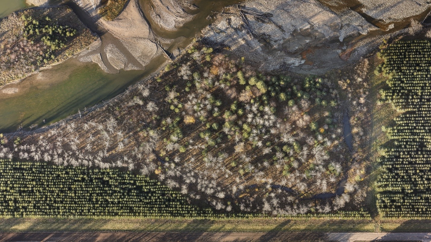
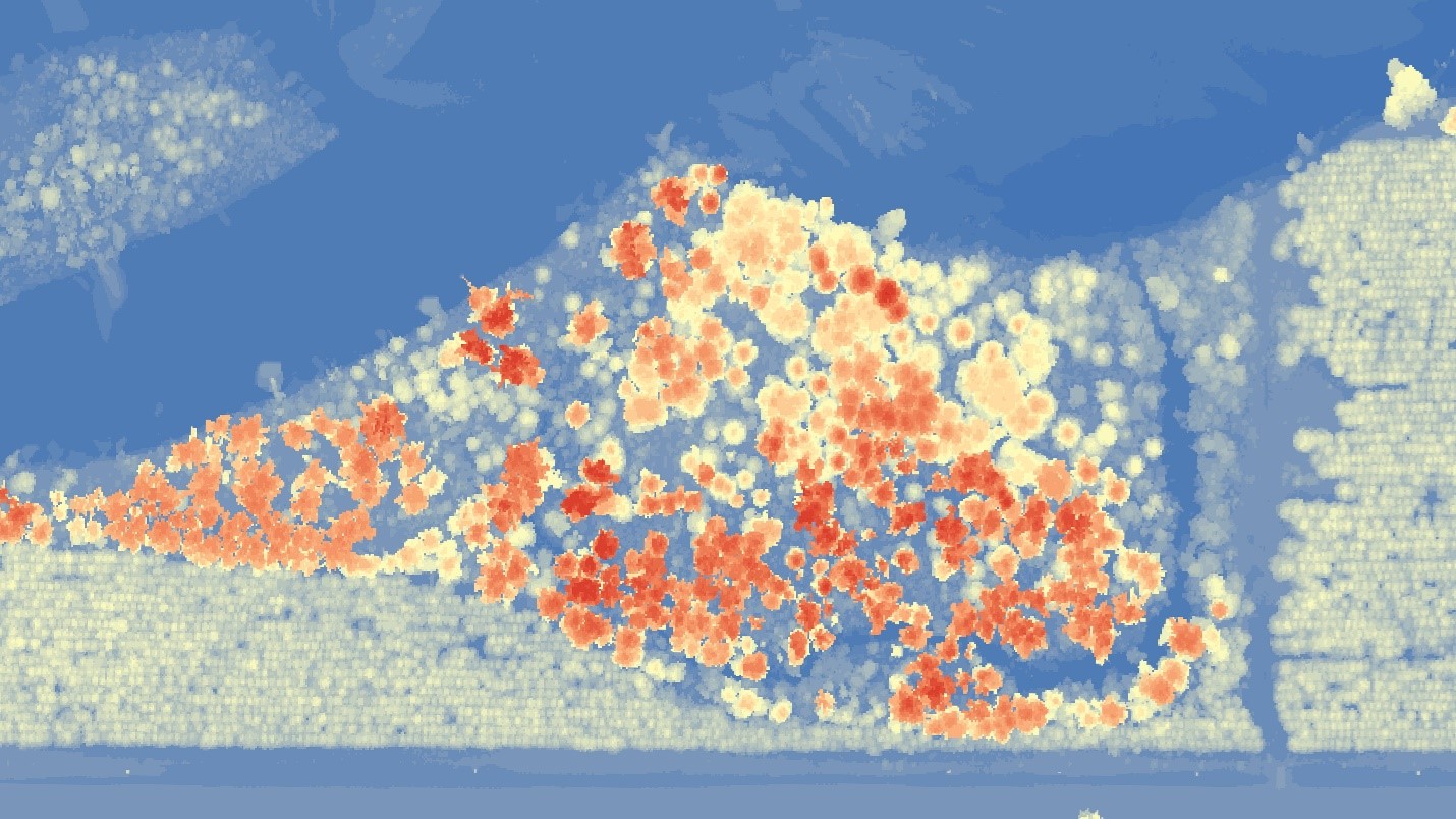
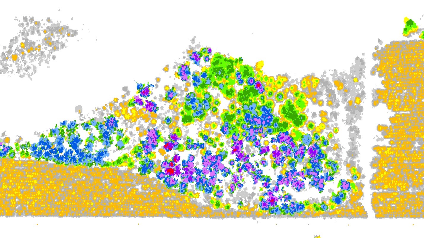
Predicting understory vegetation using remote sensing to:

  • Increase effectiveness of locating traditional use plants
  • Provide common ground for First Nations collaboration
  • Build a catalyst for changing consultation

GIS Solutions

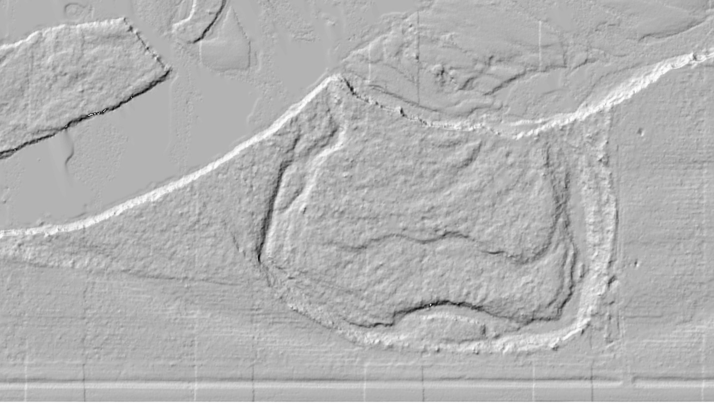
Providing GIS solutions for resource management challenges

LiDAR - No More Guess Work

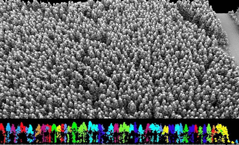
Measure tree and landscape metrics accurately and consistently

  • Bare earth models
  • Canopy height models
  • Stems per hectare

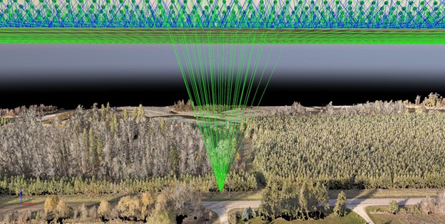
2-2500 returns per meter depending on scale

  • Individual tree heights
  • Crown Size
  • More...

UAV (Drones)

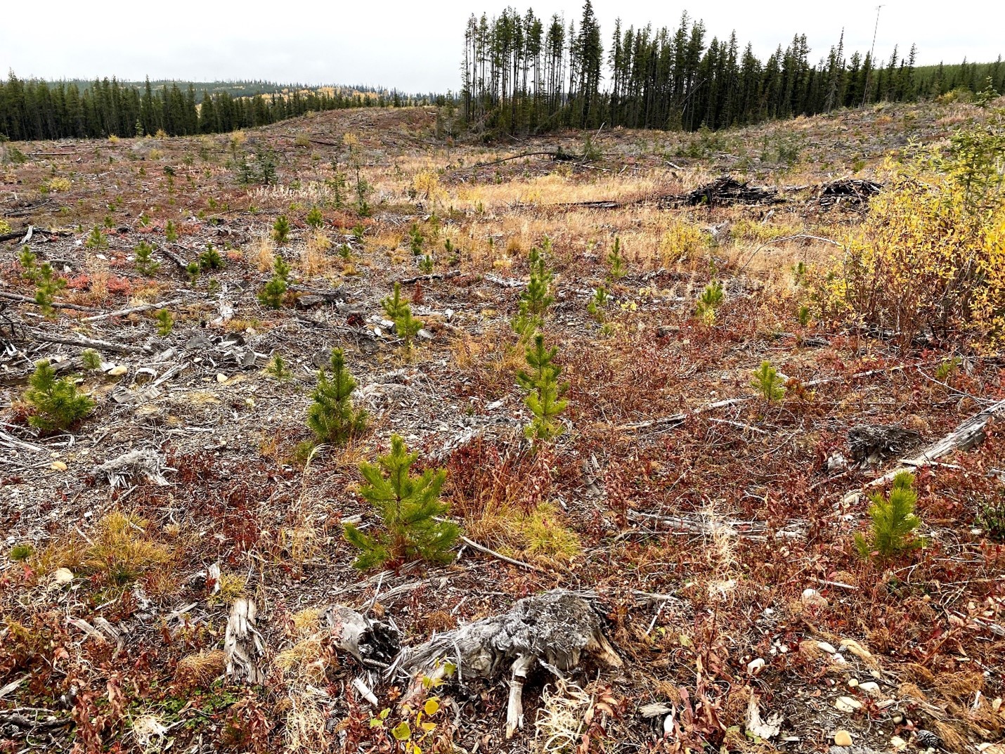
Beyond Detail - UAV data is changing the way we measure forests.

  • Operating and processing UAV data since 2015
  • High resolution LiDAR
  • High resolution imagery
  • Permanent/Temporary Sample Plots
  • Pre-harvest assessment
  • Pre-Commercial Thinning Planning
  • Research
  • High value targets are ideal for UAV work

Field Services

What good is data if it does not reflect reality?

  • Field Sampling Design and Management
  • Permanent/Temporary Sample Plots
  • Inventory Plots
  • RSA Calibration/Validation
  • Anthropogenic Disturbance plots
  • Ecosite Identification
  • Destructive Sampling

Innovative Solutions - Changing the Game

Remote sensing is changing forest management. No more educated guesses or assumptions. Now we have the technology to KNOW!

We want to help! Take your management to the next level. The best management starts with the best data.

Our Achievements

Over 20 Years of Service


50 Million Hectares of Vegetation Inventory Programs


Over 30 Years of Industry Experience

Contact Us

(780) 484-8461 [email protected] #201, 10565 172 Street, Edmonton, AB T5S 1P1